Search
Close this search box.
Search
Close this search box.
Search
Close this search box.

ASEAN Heritage Parks

Chu Mom Ray National Park

The Park is named after Chu Mom Ray, which, at 1,773 meters, is the highest mountain in the region. Chu Mom Ray National Park is adjacent to Virachey National Park in the Stung Treng and Ratanikiri provinces of Cambodia, and the Southeast Ghong Natural Reserve in the Attapeu province of Lao PDR

Covering 56,621 hectares, Chu Mom Ray National Park is situated in western Kon Tum province, in the Central Highlands, close to the point where Viet Nam, Cambodia, and Lao PDR meet.

Photo Gallery

Location
Western Kon Tum province, in the Central Highlands, close to the point where Viet Nam, Cambodia and Lao PDR meet
Area
100.48 sq km
Date declared as an AHP
18 December 2003, at the Signing of ASEAN Declaration on Heritage Parks
Other international designations
Habitat types
Contact Information
MR. DAO XUAN THUY
Chu Mom Ray National Park

Unique Flora: The Park harbors two orchid species believed to be endemic to southern Indochina: Coelogyne schltesii and Bulbophyllum amitinandii.

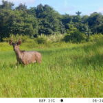
Unique Fauna: Tigers, the Asian elephant, gaur, and banteng have been recorded in the Park. This National Park also supports globally threatened and restricted range bird species, including Germain’s peacock pheasant (Polplectron germaini), and the black-hooded laughingthrush (Garrulax milleti).

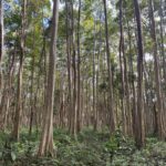
Habitat Types: Major forest types include lowland evergreen forest, lower montane evergreen forest, lowland semi-evergreen forest, bamboo, and grasslands.

Added attractions in the Park include the Seminary, Ethnic Hill Tribe Museum, Wooden Church, and Kontum Prison.

Explore Other Parks

Philippines

Mts. Iglit-Baco National Park

This national park is the only place in the world where one can find the biggest remaining population of the tamaraw (Bubalus mindorensis). It features Mt. Baco (2,488 meters above

Read More »
Viet Nam

Lo Go-Xa Mat National Park

Situated in the transition between Central Highlands, Southern Lowlands, and the Mekong Delta, Lo Go-Xa Mat supports low hills, seasonal inundated grasslands and swamps, natural rivers and streams etc. This

Read More »